 |
|
Republic of New Lemuria
|
|
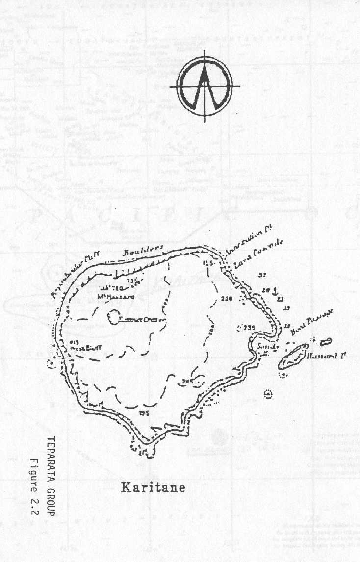
Karitane |
|
|
|
"FANTASY ISLAND?"
Karitane, which has become known as "Fantasy
Island" is considered by the Kingdom of Polynesia to be a part of the
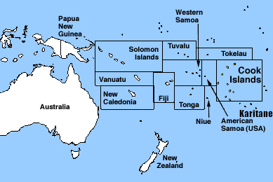
Polynesian South Pacific group of unnamed and/or uncharted islands south of the
territories of the Cook Islands and south of French Polynesia. Its 'king',
"Mitchara" seems to be itinerant without any permanent residence who
claims to travel in his ship from island to island and throughout Southeast
Asia. Republic of New Lemuria met KOP's "prime minister" through an entity aspiring
to ecclesiastical statehood calling itself the Kingdom of Acacia..
Karitane is believed to be located in the region of approximately 24.10 degrees
south latitude and 158.37 degrees West longitude.
|
|
Click on map for full page view.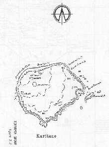 According to one eye witness, Karitane is a small island or Shoal of
low elevation mostly populated by mangroves. Another eye witness, a former
native of Rapa, said that Karitane is south of Rapa below the territories
of the French Polynesia. A few world maps reveal small
double circled dots (a seamount?) at the above coordinates, however, map
makers have not yet been requested to print the name of Karitane or Republic of
New Lemuria next to said dots.
According to one eye witness, Karitane is a small island or Shoal of
low elevation mostly populated by mangroves. Another eye witness, a former
native of Rapa, said that Karitane is south of Rapa below the territories
of the French Polynesia. A few world maps reveal small
double circled dots (a seamount?) at the above coordinates, however, map
makers have not yet been requested to print the name of Karitane or Republic of
New Lemuria next to said dots.
It has been reported that the French Navy went looking for Karitane,
but if they did, and found it, they may have nuked it, in retaliation for
Republic of New Lemuria's spiritual war that caused the French to stop their nuclear
testing in the South Pacific two tests ahead of schedule, because the claim
by the press is that it was 9 meters under water when the French checked
it out. However, since Republic of New Lemuria has never given the exact coordinates of Karitane,
where did they look? Nine meters below sea level sounds better than
the 1,000 feet below sea level; and that is what the WSJ has reported the
U.S. State Department as having stated, that it "seems" that the coordinates
below are focused on a seamount less than 1,000 feet below sea level.
Should it turn out to be true that Karitane is slightly below the surface, Republic of New Lemuria could employ the Caribbean strategy of Prince Lazareth of New Utopia
to build a sea city and connect it to the reef below the surface..
|
|
 In fact, here is a quote from Taio Shipping,
Ltd in Rarotonga, Cook Islands, a more credible source than rumors
spread throughout the media via a reader of the South China Morning Post
about what the French did or didn't do: "Tradition of Rarotonga and
Mangaia asserted that Tuanaki, lying about two days sailing by canoe SSW
of Rarotonga, consisted of three low islands within one reef. Tuanaki
(not to be confused with Taongi, a well documented island in the North
Pacific) was reputed to be thickly populated and had often been visited
by canoes from Rarotonga, but the island has since disappeared. Maretu
accompanied the Reverend William Gill searched for a week for Tuanaki in
June 1843. Other references to Tuanaki, some of them based on Maretu's,
include Smith 1911. Pacific Islands Monthly, August 1964 :77 and Coppell
1973 :45-6. There is allegedly a shoal (Karitane?) at about the locality
indicated by the tradition, and it is possible that this was an atoll
that was submerged by tectonic activity. Captain Nolan of the Peri
reported sighting an island very low at lat. 24~25', longitude
159~40'(Karitane coordinates?), but he did not go near it."
In fact, here is a quote from Taio Shipping,
Ltd in Rarotonga, Cook Islands, a more credible source than rumors
spread throughout the media via a reader of the South China Morning Post
about what the French did or didn't do: "Tradition of Rarotonga and
Mangaia asserted that Tuanaki, lying about two days sailing by canoe SSW
of Rarotonga, consisted of three low islands within one reef. Tuanaki
(not to be confused with Taongi, a well documented island in the North
Pacific) was reputed to be thickly populated and had often been visited
by canoes from Rarotonga, but the island has since disappeared. Maretu
accompanied the Reverend William Gill searched for a week for Tuanaki in
June 1843. Other references to Tuanaki, some of them based on Maretu's,
include Smith 1911. Pacific Islands Monthly, August 1964 :77 and Coppell
1973 :45-6. There is allegedly a shoal (Karitane?) at about the locality
indicated by the tradition, and it is possible that this was an atoll
that was submerged by tectonic activity. Captain Nolan of the Peri
reported sighting an island very low at lat. 24~25', longitude
159~40'(Karitane coordinates?), but he did not go near it."
The officially defined territory of the Cook
Islands is "Two north and south groups of 13 inhabited islands and 2
uninhabited islands. Extending over 2 million square kilometers of ocean
latitudes 8 degrees to 23 degrees south, longitudes 156 degrees to 167 degrees
west."
It is important to note that reported sightings
of Karitane are below the 23 degrees south border makings of the Cook Islands
and that no other nation than Republic of New Lemuria claims Karitane.
| Map of where Karitane Island may be located |
Click
here for view of Karitane region from 10 km above 24°15'S 158°35'W
|
|
|
|

|